Sunday, May 20, 2012

Poughkeepsie Yacht Club - At our dock

Bear Mountain Bridge - the river banks start to steepen
We left Haverstraw Bay in fabulous weather. The sky was clear and the weather warm with flat water for motoring north at top speed. The Hudson River from Haverstraw Bay north is one of the most beautiful rivers in America. You will notice very little development along the river since both sides of the river bank is occupied by train tracks put in place long ago.

The US Military Academy
The river narrows as it approaches the Bear Mountain Bridge and the sides steepen to nearby mountains. Further along you go past West Point Military Academy which trained the best of our commanders such including US Grant, RE Lee, Eisenhower and many, many others.

Storm King Mountain, imposing, right by the Hudson!
Next along the river comes Storm King Mountain which rises 1340 feet above the Hudson River giving an imposing exit to Newburgh and Poughkeepsie. Further up the river you will come to the Poughkeepsie Yacht Club in a setting with a view of the Catskill Mountains to the north. It's a beautiful ride and you ought to take it when you can.

We're now docked at PYC and will be leaving Monday for home and a different life for awhile. This marks the last blog entry for the 2011-2012 trip south. Our plans are not firm yet but we may leave again this fall around September 15 for another cruise down the ICW. Look us up then. Thanks for viewing the blog, it's been fun writing it, goodbye!

Saturday, May 19, 2012

Haverstraw Bay - At the Croton Point anchorage

The Freedom tower is progressing
The Atlantic Highlands anchorage was calm except on top of the hour when the ferry returned, then it rolled for awhile before settling back down. After the last ferry at 11:00 pm, the rest of the night was like a lake. The left around 7:30 to catch the current going north - but the northward current never materialized. We had an adverse current all the way to Haverstraw even though the current charts showed a favorable current. Has there been a lot of rain recently?

My icon is black, ship's is red - the lines cross!
Entering the lower New York harbor, AIS showed again its merit. I noticed the chartplotter display of a ship headed on a collision course for us in 10 minutes. The ship was only 10 minutes away but was not visible since it was behind Sandy Point, ahead and to the right of us. The radar didn't show a target either due to the intervening boats and buildings. However, the Garmin chartplotter with AIS capability to relay signals picked up by my installed AIS receiver did show the danger situation correctly. The fact that we were on a collision course is shown by a line extending from the ship's icon on the chartplotter to where it will be in 10 minutes. If that meets a similar line from the icon representing Fleetwing, then there is a problem. After a minute or so, the ship came into view and I changed course to pass behind the ship.

Here's the ship when it came into view, I changed course and passed behind him
In upper New York harbor there were dozens of ships, each with its AIS icon. I could tell which ones were anchored and which ones were moving and needed to be avoided. I also transmit an AIS signal so they can see me too.

Last sunset of the cruise!
Presently we reached Haverstraw Bay and the Croton Point anchorage. It was forecast to be light to no winds tonight so it is a perfect spot. We'll leave around 9:00 to catch the flood tide, at least that's the prediction and hopefully it's better than yesterday's on the tide.

Friday, May 18, 2012

Atlantic Highlands, NJ - at anchor

Nice day, nice sunset at Atlantic Highlands
We made it! After digesting all the misinformation and comparing predictions, we finally settled on our old standby, Grib. The NOAA coastal forecast predicted small craft advisory winds and waves starting at 2:00 pm but Grib didn't see those winds. Who to believe? Finally we went with Grib and left Atlantic City Friday morning at 4:45 am. It was still dark out and Ann helped me avoid the buoys that were not lit. By the time we got out of the inlet, sunlight started to filter down and we could see well enough to avoid crab pots although we didn't see any the entire way up, don't know why.

As we motored north (wind on the nose, of course!), the weather worsened behind us but we were able to stay ahead of it. By noon time, NOAA changed their own forecast to agree with Grib by delaying the small craft advisory from 2:00 pm to 8:00 pm although it's to be in effect until Sunday afternoon. This experience has further reinforced our belief in using Grib as our primary forecasting tool for making outside passages. You too can use Grib by downloading the free program for your PC (or iPad) that goes after the Grib data (free) and then displays it in graphical format for easy interpretation. Included are displays of wind speed, wind direction, cloud cover, wave height and direction, precipitation amounts, barometric pressure (and probably a few other things I've forgotten) every 3 hours overlaying a map of the area of interest.

We're now anchored in Atlantic Highlands which has lots of empty moorings at $50 apiece. There's lots of room to anchor and besides, who wants to pay $50?? Tonight we're the only boat here, not many made the trip north I suppose. On Saturday we're headed for Haverstraw Bay and the next day on to PYC.

Thursday, May 17, 2012

Atlantic City - Enough already...

By the outdoor pool 6 floors up, they had a fire pit to keep you warm
When we first arrived here last Sunday, storms were on the way and they kept building the winds and waves to the extent that we opt'd to stay for awhile in Atlantic City. The first series of forecasts painted a picture of Saturday being a good day to head north but then a following storm out in the Atlantic started to close the gap. So we gritted our teeth and said we were going to head out either Friday or Saturday although neither day looked very good. Today, Thursday, was not a good day. One 42' sailboat down the way went out this morning only to return to the marina after a couple of hours, very rough!

Gold is a very popular color - wonder why


So anyway, Friday's forecast as of yesterday was to  be 15 - 20 kts winds with gusts to 25 kts and 3-4 ft waves, not much fun since the wind was out of the northeast, the direction we were headed. I downloaded a grib forecast and it didn't agree with the coastal forecast I just referenced. What to do? Saturday's forecast was 10 to 15 and gusts to 20 but with 3 to 5 ft waves. However, the latest forecast now agrees with what grib said 24 hours ago! So now Friday is to be 10 to 15 with 3 to 4 ft waves, something we can live with but the winds are to increase later in the day so we plan on an early start, around 5:00 am.

All these forecasts can drive you crazy. They are always changing and you wonder if anybody knows anything at all about the weather?! I'll get up at 4:00 am Friday morning and check the forecast again and hopefully the weatherman won't suddenly find a hurricane he somehow missed yesterday! (but I wouldn't put it past him!) You can find out if we left and track our progress up the coast on Spot, the link in the left panel on the blog.

Our destination is the Atlantic Highlands anchorage, at the end of the mooring field, hopefully by 5:00 pm or so. It will  be a long day for us.

Wednesday, May 16, 2012

Atlantic City - We visit the boardwalk

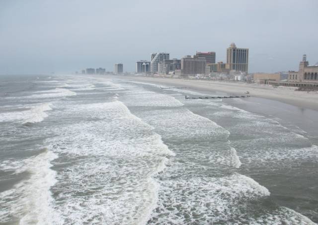
Incoming waves at Atlantic City - sigh....
We took advantage of the $0.75 per ride cost on the Jitneys and visited the boardwalk today. It's a wild ride over there. The Jitneys are mostly privately owned and they are paid based on the number of passengers they pick up. Therefore, they do as fast as possible to pick up as many customers as they can to maximize their revenue. Speed bumps - what speed bumps! Curves? No problem, just go slow enough so the Jitney doesn't turn over, otherwise, full speed ahead. They don't crash since that would also impact profits - but they do get there in a hurry.

One of two Vickings being delivered, somebody has money
We got off at Caesar's Palace and walked through the casino to the pier with many stores and a nice lunch type restaurant on the third floor. Caesar's is the best kept casino we've seen so far. Ann likes to look through the stores on the pier and we both like to see what's happening out on the ocean where we hope to go someday...  We watched the "Dancing Waters" display (see video) and went for lunch upstairs. The waves are still coming in pretty good (see video). We met one couple that had stayed at Cape May long enough to get bored and set out for Atlantic City this morning. They encountered 5 to 7 ft waves along the way and are not eager to set out again in conditions like that! We certainly are not about to endure such tossing about and will be waiting for calmer weather.

This  boat will pass by PYC in a few days going north


So in the afternoon it was upstairs again by the pool and then down for Happy Hour in the Chart House for 1/2 price drinks and appetizers. There are certainly worse places to be stuck waiting for weather but we'd rather be moving north. Returning to the boat we met a Beneteau powerboat team making the Loop. We got T-shirts from them and alerted them to wave to PYC as they pass by the club, probably in a couple of days given their cruising speed at 20 kts! All this time we look at the weather reports about every three hours! Saturday looks like a maybe, Sunday is more probable and Monday is even more probable. It all depends on one's tolerance for wave endurance on when to go. The boat can take it fine, it's the crew that's the problem.

Tuesday, May 15, 2012

Atlantic City - Rain, rain and more rain!

No exit today from Atlantic City!
We awoke to howling winds, the front had arrived. Shortly thereafter the rains came and stayed for hours. There was no going outside so we did inside things most of the day. I complained to the dockmaster about the bad weather but it did no good...  The inlet was really churned up (see photo!) and now the Atlantic is churned up too. It will take several days for the waves to subside to a level that's comfortable to us. If I believe the weather forecasts (Ha!), the window is still Saturday or possibly Friday for going north.

That's our little boat at the bottom left - Fleetwing
We decided to tour the Golden Nugget again to view the fruits of the renovations which are still in progress. On the 6th floor, they installed a heated swimming pool with two Jacuzzi tubs for outdoor relaxation even in cool weather although not many people were availing themselves of the opportunity today. From the 6th floor we had a good view of just how small our little boat was compared to the behemoths nearby, the largest being the yacht Boardwalk belonging to the owner of the Golden Nugget I talked about yesterday. According to on line reports, he's worth about $1.3 billion so filling up a 20,000 gallon diesel tank is no big deal.

Not quite summertime - but comfortable nevertheless
On the way we check on the status of our winning a pound of gold, a daily giveaway at the casino - so far no luck. We're hoping for more luck come this weekend when better weather is predicted. On Wednesday we'll head over to the boardwalk to further explore Atlantic City and view the surf on the beach, hopefully subsiding.

Monday, May 14, 2012

Atlantic City - We try the buffet

Part of what $150,000,000 renovations will buy
I checked the marine forecast this morning and found that a small craft advisory had been issued for the area we had to cross on the way to the Atlantic Highlands. Furthermore, the forecast only got worse over the next few days with wind and waves increasing. The earliest relief appeared to be Friday or Saturday, most likely Saturday. Luckily, the Golden Nugget marina has a weekly rate that totals only $1.20/ft per day if you have a Marina Life membership, which I do. Oh well....

So, it's time to make lemonade. First I had to get rid of the ICW mustache, after all we were docked right in front of the hotel, the second dock out. For transportation Atlantic City has the jitneys, an independently owed fleet of small vans to move customers around. The normal fare is $2.25 per trip, one way, which gets rather expensive fast. On their website I discovered they had a senior rate of only $0.75 per trip but you had to buy the tickets in advance at one of their centers, a big pain - but then a big savings too. I took a jitney into town to their center of operations, pushed the button on the door which signaled the office inside to open it (yes, it appeared to be one of those places where you might want to have your front door locked at all times...), I came in and bought a book of tickets (only sold in books of 10). Standing outside, I thought it better that I move further south and then discovered that one ought to stand in front of a casino instead, otherwise, nobody gets off and the van is full, no room for you. Eventually I got back to the boat.

Engineer for the Superyacht Boardwalk
I had a conversation with the engineer for Boardwalk, the huge 162 ft superyacht docked in front of us. It turns out that it belongs to the owner of the Golden Nugget. Being an engineer, he's interested in the numbers on the boat, one being the fuel capacity of 20,000 gallons! How would you like to pay the refueling bill for that!  The 20,000 gallons will get you about 1000 miles before requiring another refueling. For now they will be docked here, they don't move often.

For dinner we were going to try Happy Hour at the Charthouse but found that their Happy Hour was not held on Mondays. With that we tried the buffet which was okay. Tuesday we'll use one of our $0.75 tickets to explore the boardwalk (by the ocean, not the superyacht) and, of course, keep abreast of weather reports.

Sunday, May 13, 2012

Atlantic City - At a dock

Renovated - Now the Golden Nugget - repainted golden
We left Cape May at 7:00 headed north. The forecast was for increasing wind and waves as the day proceeded so we wanted to reach Atlantic City before the worse of the winds kicked in. We were successful in arriving before noon after we picked up a favorable current allowing us to average 8 kts northward. The trip along the New Jersey coast was uneventful with winds not exceeding 15 kts, not bad.

Atlantic City continues with some major dredging!
We hit the Atlantic City inlet at slack tide so the entrance was without excitement. We chose to anchor off the Coast Guard station in front of the bridge. At first the anchorage was fine. There was a fierce current and winds of 15 kts but the anchor held firm. I put out 85 ft of chain/nylon in 15 ft of water and we never moved an inch. Later in the afternoon, the winds piped up to 20 to 25 kts and we were still secure but the tide had changed and now we were sideways to the incoming waves and the boat took to a severe side to side rocking, about 20 degrees per tilt. That was enough to convince us to retreat to the Golden Nugget Marina (aka previously as Trump Marina)  Weighing the anchor was interesting in the 25 kt gusts and waves. Although we only had 85 ft out, the anchor never moved an inch is all the wind. However, with Ann moving the boat forward, I was able to pull the anchor up vertically with the windlass, no mean task in the pitching of the boat with the waves.

They have a great fleet in town - ought to have lots of fresh fish
We then headed for the marina and pulled into a slip partially shielded by a huge yacht, peace at last. The Golden Nugget took over the Trump Marina complex and poured $150 million into a complete renovation of the resort which we plan on exploring tomorrow. The weather reports for the next few days are not good for moving north. Now it's looking more like the weekend before the weather clears enough for a comfortable trip to the Atlantic Highlands. For us, it's not what the boat can take - it can take a lot - it's only about what we're willing to endure for the next 85 mile leg (not much!) So we'll hang out here, waiting for a "comfortable" weather window.

Saturday, May 12, 2012

Cape May - At anchor

Cape May at night - that's Saturn in the sky
We had started out for an anchorage much closer at Cohansey River but we caught the outgoing tide and would have reached our destination before noon so we decided to soldier on to Cape May. Delaware Bay was quite tame, unusual to be sure, so we just had to take advantage of it. Leaving at 8:00 from Chesapeake City, we reached Cape May at 5:00 pm. We had arrived too early to take the canal since the bridges were only 55 ft high, the same as our mast. It's not comfortable watching your mast approach a bridge that looks for all the world much lower than what's on your boat! So, we took the outside route that runs close to shore, always an exciting trip with the waves and wind pushing you to the sandy beach - with the people waving! However, the charts are correct and can be followed with confidence.

On the Delaware Bay - Zero carbon emissions energy
After refueling, we made our way to the anchorage and found that we had it all to ourselves. We were very surprised that we were the only boat there. I ran Hoolie ashore and we settled down for the night. Even here we had TV over the air, 33 channels. It's a rare anchorage or marina where we didn't get at least 20 to 30 channels but it does happen occasionally, twice in the last month.

We appear to have a weather window to reach Atlantic City if we leave early in the morning. If we miss that window (or it is revised), then we'll have a four or five day wait for the next window, at least according to the last forecast we saw tonight. As always, the weather rules.

Friday, May 11, 2012

Chesapeake City - At anchor

Calm now - had 25 kt winds at first
The Coast Guard had a small craft advisory out for today but we looked at the forecast and decided that it was fine for our boat so we headed out anyway. We did get an early start knowing that the higher winds usually come in the afternoon. In the direction of the Chesapeake - Delaware Canal, the bay narrows as you proceed northward so any high winds have less of an effect on the wave action. Regardless, as we approached the entrance to the canal, the winds piped up to over 20 kts, topping out at 24 kts! With that we took the mainsail in and entered under bare poles.

Main street Chesapeake City
Chesapeake City has a large anchorage area for visiting boaters, free of charge. In fact they also have three free docks too but we prefer to anchor when possible. Being the first ones in the anchorage, we had the choice of the best spots but there was plenty of room for others. That brings up one of the boating rules. Recall that Rule 1 was  "Wind is always on the nose", Rule 2 was "Phone calls are always when docking". Now comes Rule 3, "When first in an anchorage, all later boats will anchor right next to you" - Even when there's plenty of room elsewhere. It's like a herding instinct for boaters. I've noticed the phenomena all up and down the ICW. Tonight we were the first in and boat number two thought the second best spot was right off our bow and boat number three liked our port side, real close. Meanwhile, the rest of the spacious anchorage as well as the free dock was empty, go figure.

New range finders for the approach to the canal
Both boats did provide some entertainment in anchoring. Boat number 2 tried our port side but couldn't get his anchor to set and finally settled on our starboard side after a few tries. Boat number 3 tried at least four times to set their anchor which included circling us three times in the process. I guess they figured that I had found a spot that held an anchor and they wanted to share in the security of a good set. There is no secret here, all you need is a modern anchor (Spade or Rocna, for example) and chain. There are lots of opinions on chain but I use 60 ft of 3/8 inch BBB chain for weight to form a good catenary. I entered the harbor, Ann headed into the wind, stopped the boat, I dropped the anchor as she backed, laying the chain on the harbor floor in a line (not piled up!), snubbed the anchor, causing the boat to stop. No rev'ing in reverse! The backward motion of the boat is enough to set the anchor. It will continue to get a better bite with the back and forth motion of the boat and increase holding power thereby. The entire procedure took less than 5 minutes and we're done for the night, no sweat - easy.

We're headed to the Cohansey River Saturday for an anchorage and then on the Cape May the next day, hopefully.

Thursday, May 10, 2012

Annapolis - A Pusser's Lunch

The ducks liked to roost on our dinghy - with predictable results requiring cleaning!
When we were in the British Virgin Islands (BVI) for one of our six charters, a visit to the nearest Pusser's was always on the to do list. Since there is a Pusser's at Annapolis, we had to go there. Normally we would have their famous Painkiller but it was a bit early in the day (2:30 pm) so we just had the rum punch with our lunch. The restaurant is right on Ego Alley so you get a good view of the boats coming and going even though it was a bit chilly today with a high of only in the 60's.

One of the many day sailing boats operating out of Annapolis
Today was not a travel day given the high winds topping out at 30 kts and 3 ft seas in the bay and this morning they extended the small craft advisory into Friday, a change from yesterday. So now it looks like we'll sit out yet another day and leave for Chesapeake City on Saturday instead of Friday as we had planned. There are many other boats in the same boat (so to speak), all waiting for weather.

Love those translucent sails
Meanwhile, I dived in again into the depths of the genset since it wouldn't start yesterday. There appeared to be a loose connection in the starter relay socket so I removed the sockets (all three) for testing. There's a trick in getting the female plugs removed from the socket and once I learned that from Panda technical support, I had them out in no time. So, after removing the plugs, clamping down on each of the two grippers to close them further for a tighter fit to the male prongs of the relay, I reinserted the sockets and relays. The genset started right up but then it's done that before when I've worked on it. The real test will be over the next few weeks to see if the genset stays fixed. Now all this may not sound too exciting but it's exciting to us when the genset doesn't start! You eventually learn to be your own mechanic, at least for the things you can fix - which expands as you gain experience (not from lessons but rather from the necessity of doing).

So, we're just waiting for weather along with a dozen other boats in the mooring field, looks like Saturday now.

Wednesday, May 9, 2012

Annapolis - at a mooring

Notice the small float to the left, there were two following the boat - remote sonar for fish?? Anybody know?
The forecast was mixed. At first they predicted 2 to 3 ft waves with winds 10 to 15 so we decided to set out but after we cleared the point outside Solomons Island, the forecast changed to 5 to 10 kts of wind with waves 1 to 2 ft, like a lake. We had 44 miles to go so we were grateful for the calm conditions even though it rained much of the way.

Weather station - know the actual wind speed via the internet
One thing you have to look out for are the fishing weirs that surround approaches to Solomons. They have the appearance of fences set in the water. Needless to say, you have to go around them. For some reason, Solomons seems to have a lot of them.

Ego Alley - At Annapolis
Given the calm conditions, we chose to continue on to Annapolis instead of ducking into the Rhode River anchorage, it was only 2 more miles would have been 10 miles to go from Rhode River to Annapolis (it's a long way into Rhode River). We were wary of the moorings at Annapolis since we've experienced a lot rolling the last time we were there when the wind was out of the east. The waves just roll into the mooring field and sets everyone rocking side to side. However, for the next two days, the winds are to be out of the northwest which should be okay for the moorings since there's no opening to the bay from that directions.

Always race day at Annapolis!
We chose mooring #1, right next to the entrance to Ego Alley so we could watch all the boats pass by. I think they race every day here, at least I've never been here when the racers haven't come in at night. It's a pretty sight to see the sailboats with their fancy sails go by.

On Thursday the winds are to be 15 to 25 with higher gusts and 3ft waves or higher so we'll stay put and leave on Friday for Chesapeake City if the weather permits.

Tuesday, May 8, 2012

Solomons Island - At anchor

"Come on, what's keeping you..."  Notice one in front and one in back
We had expected to  be here until Friday or Saturday but suddenly the weather forecasts have changed so it looks like we will have a window to leave on Wednesday, but you never know with the weather. The small craft advisory is still in effect but due to expire tonight along with the high winds. If nothing else on this trip, we've learned not to depend on forecasts more than 1 day old. So, on Wednesday morning we'll check the current weather and what the weatherman thinks will happen, toss the dice and see what to do. As it stands now, we'll probably leave for Rhode River.

There are two birds here - later doing what birds do in the spring...
Meanwhile we just enjoyed the anchorage which is so far back into the river that we didn't feel any of the 20 to 30 kt winds out on the Chesapeake (or the 5 ft waves either!) It's all supposed to subside by Wednesday, we'll see.

Ann started a new pastel and I installed a new cockpit light and got a few things at the nearest convenience market - so we're ready to depart. If all goes to plan, we could be home before the Anchors Aweigh party at the PYC but I wouldn't count on it - the weather being what it is. We go when we can, no pushing.

Monday, May 7, 2012

Solomons Habor Marina - At anchor just off the docks

At anchor in the Solomons
Suspecting the winds were going to pick up in the afternoon, we left Onancock at 7:15 this morning bound for Solomons Island. Sure enough, the calm winds of the marina gave way to 15 to 20 kt winds once out on the Chesapeake! We've found the anchorages in the Chesapeake to be very deceiving. It may be calm but you'd better believe the forecast by NOAA for the Chesapeake Bay. Last year we did not believe and headed out twice when the winds in the anchorage were 5 to 10 but found the forecast for the bay to be accurate at 20 to 30 kts! This year we no longer dispute the bay forecasts, it's usually worse than predicted, not better. Along the way we saw a sailboat headed south! Now that was into the wind and the waves, I took the opportunity to shoot a video of his progress, you can see it here.  Pardon me for the shaking of the camera but it was a little rough out there.


We first met "Nessie" in the Dismal Swamp lock


Today we had winds and waves on the aft section which made for an unstable ride. The autopilot could not keep up with the motion so we had to hand steer most of the way. After a 55 nautical mile trip, we made it to Solomons, MD just as the Coast Guard issued a small craft advisory. Solomons Island is a major destination for boaters in the Chesapeake but we're early in the season so it's not so crowded now. There are lots of marinas but also lots of places to anchor. With the weather forecast not so good for the next few days, we'll spend at least the next four days here. At least it's free here in the anchorage except for the $2 daily fee for use of the dinghy dock at the Solomons Harbor Marina. The winds for the rest of the week are projected to be 20 to 30 kts, a bit much for northing so we'll sit it out for awhile.

Our next destination, when we get the chance, will be either Annapolis or Rock Hall, depending upon the wind direction. Meanwhile, we'll rest up and catch up on movies from the nearest Redbox.

Sunday, May 6, 2012

Onancock - Johnny Mo holds forth

Just watching the sunset off the back of the boat, how to improve the day?
Well, there is a laundromat in Onancock but it's a 20 min walk up a hill into town. Luckily, we have a cart so it's not too bad with a full load, still a long way to go. Strangely, the place was packed on a Sunday morning even though they had over 40 washers in the store. Not too exciting here but needed. For even more excitement, I washed the boat in the afternoon.

Johnny Mo, the Musical Chef
The town is well kept, reminds me again of typical Maine towns with manicured lawns and an abundance of flowering plants all around. Except for the laundromat, there wasn't much happening in town but the waterfront was buzzing. The dockmaster said this was the beginning of their season and the restaurant next door, Mallards, was rocking. Johnny Mo, the chef, was holding a party for his friends but we were invited too. Johnny was singing (he's known as The Musical Chef with two CDs out along with two cookbooks) with original songs and/or new lyrics to old songs. We used his previous cookbook, Rock the Kitchen so much that many of the pages were loose from the binding. Upon seeing that, Johnny offered his latest cookbook, Rock the Party, as compensation. As I said in previous posts, the recipes are easy to follow on a boat and result in great meals. We use his cookbook all the time.

Dockhouse to the right, Mallards in the background, convenient marina
Monday morning it's off to the Solomons Island and an anchorage. From this point on we're watching the weather and moving north when conditions permit - weather rules now.

Saturday, May 5, 2012

Onancock - at the town dock

The room filled up a few moments later for the Derby
We made good use of AIS (Automatic Identification System) today. We were crossing shipping lanes today getting from the western shore to the eastern shore where Onancock is located. At one point I noticed a tanker coming at us from the port side. It was hazy outside so the tanker was not in view and also beyond our usual 3 mile radar scan but it was clearly visible on the chartplotter as an AIS target. The line that projects forward from the target shows where it will be in 10 minutes. A similar line is shown on the icon representing Fleetwing's position in 10 minutes. If the two lines meet, then you have a collision in the making.  In this case, the two lines met perfectly. If I continued on my present course, one of use would not survive. Therefore, I changed course since I didn't want to damage the tanker and went behind him... All these decisions were made before the tanker was even visible in the light fog. I also transmit an AIS signal so the tanker can see me too. I do like AIS.

Part of the fun of cruising is meeting such nice people along the way
We arrived at Onancock and took on fuel and docked. We were eager to come here since we like to dine at Johnny Mo's restaurant, Marllard's. We've used his recipe book for the past year, it suits boat cooking very well, relatively simple but very good.

This is the second year we just happened to hit Johnny Mo's restaurant at the time of the Kentucky Derby and Ann, who is an avid fan of the Derby, and I watched the running in the bar area of the restaurant, exciting! The dinner was equally entertaining (for us) and we left satisfied after a well prepared meal. We'll be here another day to explore Onancock downtown since the winds are not predicted to be favorable for northing until Wednesday.

Friday, May 4, 2012

Deltaville - At Fishing Bay YC

Very peaceful anchorage
We had intended staying another day at Hampton but the weather forecast was for strong winds out of the north for Saturday so we thought discretion was the better part of valor and headed north today to Deltaville. For once the prediction for winds in the 5 to 10 range out of the south was spot on and we motored north comfortably with very little wave action.

Here's Walt telling us of his future adventures
The route into the yacht club is daring with  one turn only yards off the obviously shallow beach  but the way is marked with buoys and as long as you obey them, you will stay afloat. The big attraction here is the free dock offered by the Fishing Bay Yacht Club for the first night's stay - provided you below to a recognized yacht club (listed in the yacht club directory for the US).

The sled for the Atlantic
On our first try for docking, I got too far off to the east and ran aground, the first time this cruise. I rev'd he engine in reverse and backed off before turning the wheel and rev'ing forward - we plowed a furrow to deeper water. The bottom in the Chesapeake is mostly soft mud anyway. This technique would NOT work in Maine. On our second try we just came straight at the dock and pivoted in front for a sideways touch. Not a problem when there's no current and no wind.


Once docked, we were greeted by a member preparing his boat for a cross-Atlantic adventure. They have a boat that can reach 20 mph in a strong breeze, a sled design that only weighs 6000 lbs but is 40 ft long! The entire boat is built of carbon fiber and has nothing inside except the shell (no floors, no bulkheads - everything is sacrificed for for speed. They'll carry only 60 gallons of water but only for drinking, hummm..

On Saturday we're headed for Onancock and Johnny Mo's restaurant for dinner. We've used his cookbook more than any other on our cruise south. The recipes are relatively simple and the results are great!

Thursday, May 3, 2012

Hampton, VA - Provisioning

The fountain is lined with about 50 shops, unfortunately only Ann type shops
We rented a car from Enterprise for the day. Their office is right next to the marina, less than 200 ft away, very convenient! Running a boat is very much like running a house, you may not have to mow the lawn  but the chores are very similar. Add to that all the things that can go wrong on a boat exposed to the salt water of a marine environment and it actually amounts to more work that with a house. Hampton is our last stop where there's a supermarket close by so we're trying to get everything we need to reach PYC.

Even a Farmer's Market - on Thursdays
I had started a download to the iPad of a newer version of our road guidance app and it was updating all morning (it's a very large app, it has all the maps of the entire US stored so no internet calls are required) and was not available for our use in navigating Hampton. We had forgotten how much we depended upon the voice of the app (Bettie, the popular name for voice guidance). Ann's in the right seat looking at a Google map trying to imitate "Bettie" while I'm fighting traffic, Ann had the tougher job. After seeing more of Hampton than we intended, we finally settled for a Walmart instead of a regular supermarket. It seems that Hampton has no Publix, no Winn Dixie, no Kroger, no nothing except for Food Lion, a one supermarket town. Eventually we got what we needed.

Dog walk area by the bridge - it "filters out" sailboard from the anchorage


Hampton has revitalized their town with many shops and a very nice waterfront. At only $1.25/ft  with the third day free (if you stay for two days), it's a great value. The docks are floating concrete and they have the usual showers and laundry facilities. The only drawback are the half length fingers but we manage. Ann's taking me out Friday night to a place with 40 beers on tap and a decent menu, great!

Wednesday, May 2, 2012

Hampton, VA - at Downtown Hampton Public Piers

Exiting the canal, you start high and drop down - this time the lock door worked!
The trip through the Dismal Swamp Canal north of the visitor center was much better than the southern section. We didn't hit anything substantial, just a branch or two and we made the 11:30 lock opening. The northern section is generally deeper than south of the visitor center, usually 7 to 8 ft vs 5.5 to 6.0 for the southern section. So if a log does find its way to the bottom of the canal, you're more likely to pass over it without bumping in the northern part.

One of the several railroad bridges - it lowered right after we passed through
Exiting the locks, it was a race to reach the Gilmerton Bridge opening at 12:30. The bridge only opens on the half hour, once per hour. If you miss the 12:30 opening, then the next one is at 1:30! I rev'ed the engine to 2500 rpm and we were making 8.0 kts and made the bridge with no minutes to spare. We passed by the naval yards which had patrol boats out to ensure that no one got too close to the ships in dry dock. At one time I got too close to shore on the other side and I heard a loud speaker saying to stand off - I did a right angle turn to the middle of the channel, no one chased me so I guess it was okay. Everyone seems on a high alert around here.

Coming into our dock at the Hampton Public Piers, no one answered our calls to the marina, not on VHF and not on the cellphone. So after a few minutes, we decided to come into an empty dock. Some help arrived from fellow boaters already docked and we made it in okay. It's a little chancy since the docks are only 1/2 boat length long, limiting where to tie up. At first we ran the A/C to cool off but now we may run the heater at night, it's very cool now.

Our plans are to rent a car Thursday for provisioning and renewal of a subscription for Ann's blood pressure medicine and maybe see some sights too. The marina has a two for three deal where you pay for two nights and the third night is free so we'll stay three nights and leave on Saturday for Chesapeake Bay.